Peru
Peru is a huge country where you will find lush jungles, impressive mountains and endless sand dunes along the Panamericana. Also the amount of archeological sites is in the thousands many still undiscovered. We love the ceviche and the spicy food but we are upset about the transit police who has stopped us more than 10 times for unknown reason. Be firm and refuse to give them any money! We have done in Perú some of the best drives so far but even though the nature is amazing we are now in Lima enjoying the city’s beach life!
The drive from Vilcabamba to the Peruvian border via Zumba is all through gravel roads in pretty good condition, 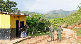 winding up and around the mountains. You will encounter sections of primary forest and jungle specially when going through Podocarpus NP and we also had a lot of fun watching a hilarious parade in Zumba. We enjoyed this beautiful drive a lot. The border crossing between Ecuador and Peru in La Balsa is very easy going and hassle free. winding up and around the mountains. You will encounter sections of primary forest and jungle specially when going through Podocarpus NP and we also had a lot of fun watching a hilarious parade in Zumba. We enjoyed this beautiful drive a lot. The border crossing between Ecuador and Peru in La Balsa is very easy going and hassle free.
One thing was clear as we crossed the border; the great road network of Ecuador was over for good. 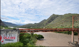 The roads in Perú are ill-maintained and its asphalt tends to disappear when it rains. As per the map there was a paved national road to San Ignacio but we only encounter 80 km of endless potholes. Still is very scenic and it is amazing as you pass by the Marañón River and the endless rice fields, it really looks like Asia. Don’t bother to stop by San Ignacio or Jaen; there are just commercial hubs for the area filled with rickshaws and mud. The road is pretty good once you reach Bagua Grande with great river canyons along the way and goes up easily to Chachapoyas. The roads in Perú are ill-maintained and its asphalt tends to disappear when it rains. As per the map there was a paved national road to San Ignacio but we only encounter 80 km of endless potholes. Still is very scenic and it is amazing as you pass by the Marañón River and the endless rice fields, it really looks like Asia. Don’t bother to stop by San Ignacio or Jaen; there are just commercial hubs for the area filled with rickshaws and mud. The road is pretty good once you reach Bagua Grande with great river canyons along the way and goes up easily to Chachapoyas.
Chachapoyas, which means “People of the Clouds”, is the name of a civilization that f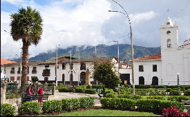 ought in resistance to Inca expansion and Spanish invasion. They flourished from around AD 800 until their violent conquest by the Incas in the 1470s. Therefore this area is filled with archaeology remains and history. Chachapoyas is a charming colonial town where you can stroll through the streets and take a look at the colonial buildings with their lovely balconies. The tourist office by the Plaza is very helpful and is having information about other parts of Perú as well. We parked our caravan at the municipality parking just behind Plaza de Armas. ought in resistance to Inca expansion and Spanish invasion. They flourished from around AD 800 until their violent conquest by the Incas in the 1470s. Therefore this area is filled with archaeology remains and history. Chachapoyas is a charming colonial town where you can stroll through the streets and take a look at the colonial buildings with their lovely balconies. The tourist office by the Plaza is very helpful and is having information about other parts of Perú as well. We parked our caravan at the municipality parking just behind Plaza de Armas.
Situated in the cloud forests around the town of Chachapoyas this impressive defensive fortress 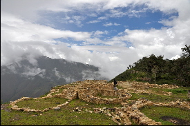 from the 9th Century can be found perched atop cliffs overlooking the Andean landscape. The citadel comprises an urban complex of more than 400 stone homes, palaces and temples enclosed by a high stone wall. It takes almost 3 hours to get there and the road is in poor condition (not many tourists) which is a shame as this archaeological site is just wonderful. To learn more about this mysterious civilization and their mummies there is a superb Museum in Leymebamba which shouldn’t be missed. from the 9th Century can be found perched atop cliffs overlooking the Andean landscape. The citadel comprises an urban complex of more than 400 stone homes, palaces and temples enclosed by a high stone wall. It takes almost 3 hours to get there and the road is in poor condition (not many tourists) which is a shame as this archaeological site is just wonderful. To learn more about this mysterious civilization and their mummies there is a superb Museum in Leymebamba which shouldn’t be missed.
The dirt road from Chachapoyas to Celendin is spectacular but not suitable for 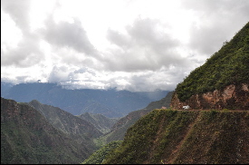 vertigo sufferers as in some areas you are driving in very high altitude where the road gets very narrow. It is sort of frightening to take a curve and not really knowing what is coming next. Luckily there is very little traffic and drivers are very careful. This is really off the beaten track and if you are looking for adventure driving with amazing landscape this is the right track for you. Once in Celendin you can chill out by the Plaza de Armas, we could listened to the local people on the stage complaining about the mining industry that has destroyed their land and water (this area is having the largest gold mines in South America). Don’t miss the colourful market day (Saturdays), it is like Ecuadorian Otavalo before it became a main tourist attraction. It took us 2 days to get here from Kuelap, you can make an overnight stop at Balsas, very relaxed village next to Marañon river. vertigo sufferers as in some areas you are driving in very high altitude where the road gets very narrow. It is sort of frightening to take a curve and not really knowing what is coming next. Luckily there is very little traffic and drivers are very careful. This is really off the beaten track and if you are looking for adventure driving with amazing landscape this is the right track for you. Once in Celendin you can chill out by the Plaza de Armas, we could listened to the local people on the stage complaining about the mining industry that has destroyed their land and water (this area is having the largest gold mines in South America). Don’t miss the colourful market day (Saturdays), it is like Ecuadorian Otavalo before it became a main tourist attraction. It took us 2 days to get here from Kuelap, you can make an overnight stop at Balsas, very relaxed village next to Marañon river.
After a long week of rough ride we needed a break and the thermals around 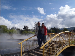 Cajamarca where the perfect place to chill out. It is understandable why Atahualpa chose this place as his home; los Baños Del Inca are located in a pretty surrounding with mild climate and great sulphuric hot springs. Don’t go on weekends it is packed. We bought the Humboldt ticket; you get your own private thermal pool for just 6 soles. Parking outside the Baños is safe. Cajamarca where the perfect place to chill out. It is understandable why Atahualpa chose this place as his home; los Baños Del Inca are located in a pretty surrounding with mild climate and great sulphuric hot springs. Don’t go on weekends it is packed. We bought the Humboldt ticket; you get your own private thermal pool for just 6 soles. Parking outside the Baños is safe.
At Cajamarca Pizarro captured and executed Atahualpa, the Inca emperor and that 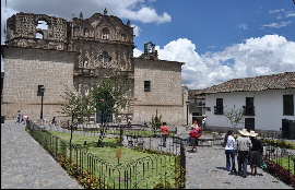 changed the course of history. Cajamarca is a very attractive colonial town; its Plaza de Armas is having a 350 year fountain, topiary and gardens and is perfect for people watching. The city has many churches, old colonial houses with garden patios and a huge lively market area. Note that the room where Atahualpa was held prisoner is closed on Mondays (we couldn’t visit it). You can also walk up from Calle 2 de Mayo, using the steep stairway, for great views over the town. changed the course of history. Cajamarca is a very attractive colonial town; its Plaza de Armas is having a 350 year fountain, topiary and gardens and is perfect for people watching. The city has many churches, old colonial houses with garden patios and a huge lively market area. Note that the room where Atahualpa was held prisoner is closed on Mondays (we couldn’t visit it). You can also walk up from Calle 2 de Mayo, using the steep stairway, for great views over the town.
Since we left Cartagena we haven’t seen the ocean so we were very happy to arrive in Huanchaco. 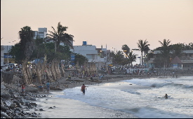 This fishing and surfing village gets many positive reviews but we think it is not worth to stay there. The sea is polluted and the beach is full of rubbish. We stayed at the best Peruvian camping so far (Huanchaco Gardens) where you will meet other caravan travellers. This was a charming fishermen village but it has grown so much in the past years that we think it is better to stay in Tortugas (see below). This fishing and surfing village gets many positive reviews but we think it is not worth to stay there. The sea is polluted and the beach is full of rubbish. We stayed at the best Peruvian camping so far (Huanchaco Gardens) where you will meet other caravan travellers. This was a charming fishermen village but it has grown so much in the past years that we think it is better to stay in Tortugas (see below).
This impressive archaeological site is located just outside Huanchaco. It is the largest pre-Columbian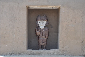 city in South America. This vast adobe city was built by the Chimu people around AD 850 and it is estimated that around 30,000 people lived in Chan Chan. Only the Tschudi Complex is open to the public. We think it is pretty amazing and well worth a visit. A lot of guides will approach you at the entrance, not sure how knowledgeable they are as we preferred to follow the path ourselves (1.30 hr. walking approx.). city in South America. This vast adobe city was built by the Chimu people around AD 850 and it is estimated that around 30,000 people lived in Chan Chan. Only the Tschudi Complex is open to the public. We think it is pretty amazing and well worth a visit. A lot of guides will approach you at the entrance, not sure how knowledgeable they are as we preferred to follow the path ourselves (1.30 hr. walking approx.).
Once we arrived in Tortugas we realised this is the place we should have stayed instead of Huanchaco.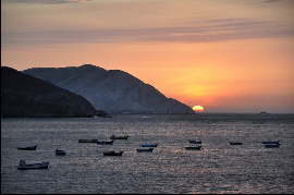 This small village got proper power supply only a couple of months ago and as locals told us they are very happy about it, but on the other hand they are afraid to lose their town to outsiders who will buy property and might build a new Huanchaco (hope not!). Tortugas is having a lovely bay with few family-run fish restaurants and we enjoyed a perfect sunset from our camping spot. We parked in front of the church by the sea. This small village got proper power supply only a couple of months ago and as locals told us they are very happy about it, but on the other hand they are afraid to lose their town to outsiders who will buy property and might build a new Huanchaco (hope not!). Tortugas is having a lovely bay with few family-run fish restaurants and we enjoyed a perfect sunset from our camping spot. We parked in front of the church by the sea.
We were told that by 2025 all glaciers in Cordillera Blanca below 5,000 meters will disappear.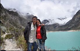 We think this might happen even earlier. The global warming has affected the area profoundly. One can see clearly where the glaciers used to be and how much they have receded. For those of you who like mountain climbing you should visit the Cordillera as soon as possible before the glaciers disappear for ever. Huaraz is a good place to gather information. We visited Lagoon Parón which is beautiful but difficult to access by camper. But the highlight of our visit was crossing the Huascarán NP via Carpa. The dirt road goes up to 4,880 meters and as you might encounter ice and snow, your car should be ready for altitude and/or cold weather, if not it is better not to attempt this spectacular “goat” track. We think this might happen even earlier. The global warming has affected the area profoundly. One can see clearly where the glaciers used to be and how much they have receded. For those of you who like mountain climbing you should visit the Cordillera as soon as possible before the glaciers disappear for ever. Huaraz is a good place to gather information. We visited Lagoon Parón which is beautiful but difficult to access by camper. But the highlight of our visit was crossing the Huascarán NP via Carpa. The dirt road goes up to 4,880 meters and as you might encounter ice and snow, your car should be ready for altitude and/or cold weather, if not it is better not to attempt this spectacular “goat” track.
The Lomas de Lachay is a National Reserve in the desert foothills close to Lima. It is located in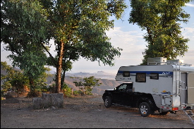 an area inland of the Pan American rolling in across the desert from the Pacific Ocean. The exit to Lachay is just after the sign; you might pass it (it happened to us) just make a U-turn at the nearby roundabout. The drive from Cordillera Blanca to Lima was very long and we decided to stay here instead of entering the city at night. It was a great choice; we highly recommend this camping spot, great view of the ocean, full of birds and peaceful atmosphere. an area inland of the Pan American rolling in across the desert from the Pacific Ocean. The exit to Lachay is just after the sign; you might pass it (it happened to us) just make a U-turn at the nearby roundabout. The drive from Cordillera Blanca to Lima was very long and we decided to stay here instead of entering the city at night. It was a great choice; we highly recommend this camping spot, great view of the ocean, full of birds and peaceful atmosphere.
We are staying in Miraflores one the prettiest suburbs in Lima close to the sea. After weeks 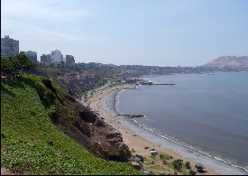 of cold nights and rain we are enjoying the city beach life. We were recommended to stay at Hitchhikers Hostel. Great location, safe and perfect to meet other travellers. Even though Lima is huge the old part of town can be visited easily by foot, we really liked the San Francisco Monastery and its catacombs under the church, both are well both seeing. of cold nights and rain we are enjoying the city beach life. We were recommended to stay at Hitchhikers Hostel. Great location, safe and perfect to meet other travellers. Even though Lima is huge the old part of town can be visited easily by foot, we really liked the San Francisco Monastery and its catacombs under the church, both are well both seeing.
The Paracas peninsula and the Ballestas Islands are part of a National Reserve 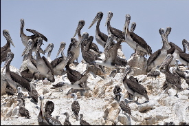 which is one of the best marine reserves with the highest concentration of marine birds in the world. In Paracas you can camp by the sea just before the entrance of the reserve after the end of the village, you will watch beautiful flamingos just in front of your door! To visit Ballestas Islands go down to the port, be aware of unlicensed agents and overpricing. The islands are spectacular with many arches and caves filled with hundreds of sea lions, penguins, guano birds, pelicans and others. Dolphins followed our speed boat. If you missed Galapagos you can get a glimpse of it here. which is one of the best marine reserves with the highest concentration of marine birds in the world. In Paracas you can camp by the sea just before the entrance of the reserve after the end of the village, you will watch beautiful flamingos just in front of your door! To visit Ballestas Islands go down to the port, be aware of unlicensed agents and overpricing. The islands are spectacular with many arches and caves filled with hundreds of sea lions, penguins, guano birds, pelicans and others. Dolphins followed our speed boat. If you missed Galapagos you can get a glimpse of it here.
Passing the wine and pisco producer town of Ica you will arrive at this little 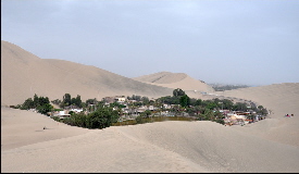 Oasis town with a round palm-fringed lake and sand dunes. Many eating places and bars with music around the curative water lake. Relaxed atmosphere mix of local families and backpackers chilling out after hiking in the Andes. Although sand-boarding is a popular activity, after living in Dubai so many years we decided to enjoy a sunset ‘pisco sour’ instead. You can park in front of the Swiss hotel but not at the neighbour’s part of the road, he gets really angry! Oasis town with a round palm-fringed lake and sand dunes. Many eating places and bars with music around the curative water lake. Relaxed atmosphere mix of local families and backpackers chilling out after hiking in the Andes. Although sand-boarding is a popular activity, after living in Dubai so many years we decided to enjoy a sunset ‘pisco sour’ instead. You can park in front of the Swiss hotel but not at the neighbour’s part of the road, he gets really angry!
If you have USD80 in your pocket and a stomach made out of steel f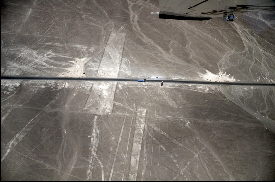 lying over the Nazca lines is an experience not to be missed, otherwise climb up the watching tower just before Nazca town (you will see the hands, the lizard and many lines which continue until the horizon). There are many theories regarding the Nazca lines but most probably they are dedicated to the worship of water and fertility. The Nazcas had a highly developed civilization which peaked around AD600. There are plenty of interesting ruins in the area: cemeteries, pyramids or underground aqueducts. It is very hot and sunny here so bring always lots of water and sunscreen with you. lying over the Nazca lines is an experience not to be missed, otherwise climb up the watching tower just before Nazca town (you will see the hands, the lizard and many lines which continue until the horizon). There are many theories regarding the Nazca lines but most probably they are dedicated to the worship of water and fertility. The Nazcas had a highly developed civilization which peaked around AD600. There are plenty of interesting ruins in the area: cemeteries, pyramids or underground aqueducts. It is very hot and sunny here so bring always lots of water and sunscreen with you.
160km from Nazca you will find a sign board for Puerto Inca. This is a 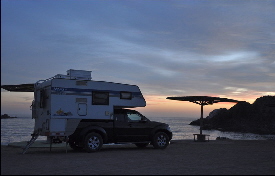 lovely beach with impressive Inca ruins: the drying and store houses can be seen as holes in the ground and on the right side of the bay there is the cemetery and a temple. Part of the Inca road is perfectly visible as this bay was the port for Cuzco. The camping ground is managed by Puerto Inka hotel. lovely beach with impressive Inca ruins: the drying and store houses can be seen as holes in the ground and on the right side of the bay there is the cemetery and a temple. Part of the Inca road is perfectly visible as this bay was the port for Cuzco. The camping ground is managed by Puerto Inka hotel.
In 2001 Camaná was on the brink of becoming the coast's next big t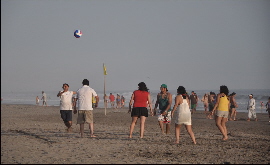 ourist destination, but a tsunami, resulting from an 8.4 earthquake, levelled hotels, homes, and restaurants. Eight-meter high waves wiped-out most beach resorts along the popular beach La Punta (5 Km long). We camped at the very south of La Punta after all the beer-sipping and volleyball spots, which is fun but can get very noisy at night. The Pan-American south is very scenic with endless sand dunes rolling over the Pacific Ocean. ourist destination, but a tsunami, resulting from an 8.4 earthquake, levelled hotels, homes, and restaurants. Eight-meter high waves wiped-out most beach resorts along the popular beach La Punta (5 Km long). We camped at the very south of La Punta after all the beer-sipping and volleyball spots, which is fun but can get very noisy at night. The Pan-American south is very scenic with endless sand dunes rolling over the Pacific Ocean.
The city of Arequipa is the second largest in the country and stands at the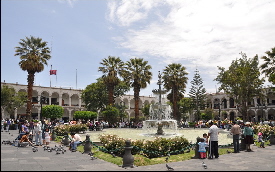 foot of the snow-capped Misti volcano and high mountains. The city has a lively vibe with many fine buildings and old and interesting churches built of sillar (white volcanic material). The Santa Catalina Convent is by far the most remarkable sight and worth visiting. Close to Arequipa towards Cotahuasi Canyon we went to Toro Muerto, the world’s largest field of petroglyphs (1500 years old). The design ranges from llamas to dancing human figures (shamans) and animals. This is an UNESCO site but the lower parts are in very bad condition, you need to climb 1hour up the dunes to see the best ones. Great views and amazing petroglyphs! foot of the snow-capped Misti volcano and high mountains. The city has a lively vibe with many fine buildings and old and interesting churches built of sillar (white volcanic material). The Santa Catalina Convent is by far the most remarkable sight and worth visiting. Close to Arequipa towards Cotahuasi Canyon we went to Toro Muerto, the world’s largest field of petroglyphs (1500 years old). The design ranges from llamas to dancing human figures (shamans) and animals. This is an UNESCO site but the lower parts are in very bad condition, you need to climb 1hour up the dunes to see the best ones. Great views and amazing petroglyphs!

|